UAVs for Antarctica
© copyright British Antarctic Survey
by Phil Anderson
copied with permission from http://www.antarctica.ac.uk/bas_research/techniques/uav/index.php
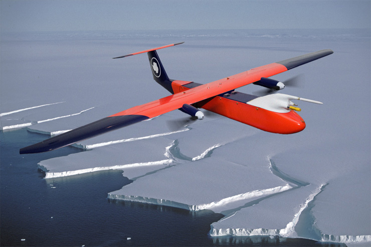
The British Antarctic Survey (BAS) took delivery of four Unmanned Aerial Vehicles (UAVs) late in 2006, ready for shipping to Halley on board RRS Ernest Shackleton . The two metre wing span aircraft will be flown over the Weddell Sea during the polar winter to measure the physics of sea-ice formation.
The UAV project is a collaboration between BAS, The Technical University of Braunschweig (TUB) and Mavionics, GmbH. Whilst BAS are focusing on sea-ice, Mavionics will use the wintering opportunity to test the system under harsh conditions, whist TUB aim to study unique aspects of turbulence over an ice shelf using Halley's Instrumented Clean Air Sector.
The 4.5 kg planes each carry a light weight miniaturised turbulence probe, which measures the detailed structure of wind and temperature along the flight path. Motion sensors embedded within the probe correct for the aircraft movement combining these records gives the heat flowing from the ice into the air . A down-looking infrared sensor measures the heat radiated into space. The difference is the rate of cooling of the ocean or sea-ice.
The UAVs are fully robotic, being programmed with GPS waypoints prior to launch. Once airborne, the computer pilot takes over, and flies the aircraft along the desired track, out of sight and out of radio range, with the data logged on board for post-flight download. Awaiting their return will no doubt be a nail-biting experience.
The aircraft are fully electric and have a range of 40 miles. To make full use of the flight they will be launched from the coast and the BAS's Vehicle Section have modified new Tucker Teracat, a QSB 5.9 litre Cummins powered snocat to be a mobile Flying Ops. room, complete with generator, computer ports and heaters.
If all goes according to plan during 2007, additional science tasks will explore the limits of the UAV capabilities. We aim to fly them over the katabatic winds flowing off Coats Land, measure the vertical extent of surface ozone depletion, and chase atmospheric waves crossing the ice shelf. The sky's the limit!
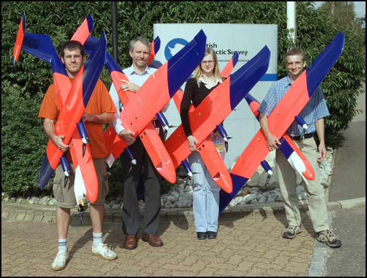
BAS takes delivery of four UAVs. © copyright British Antarctic Survey.
Left to right Michael Böhm (Mavionics GmbH) John King (ACES PI), Nadine Buchmann (Braunschweig University) and Phil Anderson (ACES/FOCAS)
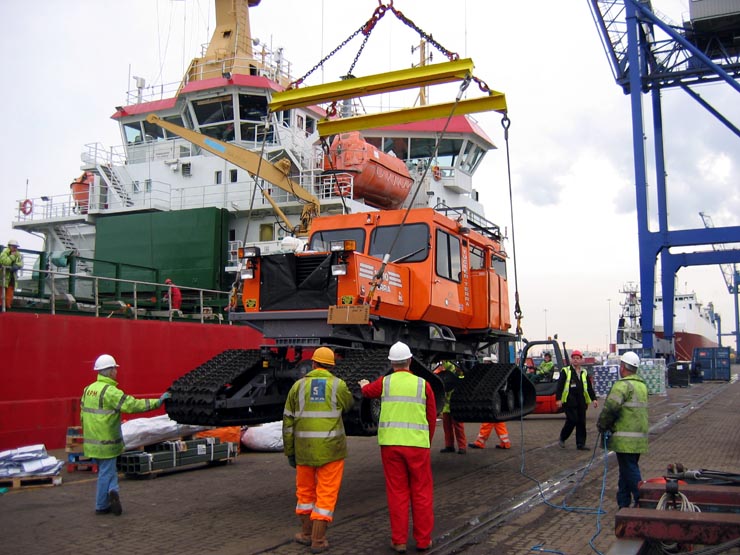
The K24 "UAV Field Operations Room" being loaded onto RSS Ernest Shackleton. © copyright British Antarctic Survey.
Robots fly into Antarctic skies
Science and Technology Reporter, BBC News
Wednesday, 19 March 2008, by Jonathan Fildes
A pair of lightweight, robotic planes have made the first unmanned flights over Antarctica's icy expanses.
Driven by propeller, the machines made 20 low-altitude sorties, including four over the Weddell Sea.
The unmanned aerial vehicles (UAVs) were launched by catapult but flew autonomously until landing.
During some of the test flights the machines were fitted with miniaturised instruments to collect data for use in predictive climate models.
"One of the biggest uncertainties in those models is the physics of sea-ice - how it freezes and how it melts," said Dr Phil Anderson of the British Antarctic Survey (BAS), one of the team that carried out the tests.
"A lot of this happens during the Antarctic winter - the nine-month period when we can't get ships and aircraft to the bases - so we decided to see if we could [collect this data] by robot aircraft."
Mobile machines
Tests of the tiny planes, which were designed by the Technical University of Braunschweig (TUBS), started in the Antarctic winter of 2007.
The 2m-wingspan craft are launched by a giant elastic band which catapults them into the sky.
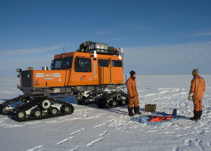
The UAVs were launched by catapult, and apart from take-off and landing, flew autonomously. A modified Tucker Snocat - seen here in the background - was used as "mission control".
Photograph from http://www.bbc.co.uk/news/technology/
It is initially radio-controlled until it reaches its target altitude of 50m, at which point the autonomous control systems kick in.
"We don't fly the mission with a radio control or with a little video camera onboard," Dr Anderson told BBC News. "It's all up to the little aircraft to make up its own mind."
However, the area in which the plane is allowed to fly is controlled by setting a series of artificial boundaries in its navigation system and the landing must also currently be radio-controlled.
In the future this will be done automatically, said Dr Anderson.
The machines are powered by lithium-ion batteries - similar to those found in mobile phones - which are able to keep the UAV in the air for 45 minutes.
In that time it can cover 45km (28 miles), taking 100 measurements per second.
"The miniaturised instruments can actually measure how much heat is flowing from the atmosphere into the sea-ice," Dr Anderson told BBC News.
This collected data can then be fed into climate models to improve their accuracy.
"We can then run [the models] into the future and get a better idea of what it holds for us in terms of the climate," he said.
Big future
Flying the UAVs in the extreme conditions of the Antarctic is not without problems.
As well as the difficulty of handling the machines in thick gloves and mitts, the cold played havoc with the sensitive electronic equipment and even the elastic bungee cord used to loft the craft into the air.
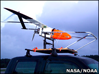
Other scientists are using UAVs to track hurricanes, Photograph from http://www.bbc.co.uk/news/technology/
"We found that it set solid at -10C; so we had to build a very long, snaky duvet cover to go over the bungee just to keep it warm enough, long enough, to do the launch," he explained.
However, Dr Anderson believes the craft will play a big part in future exploration of the continent, surveying hard to reach and dangerous places.
This capability has been exploited for a long time by the military which uses UAVs for surveillance and communication.
As such, research efforts are ongoing around the world to boost the endurance, range and capabilities of craft.
Last year, UK defence firm Qinetiq smashed the official world record for the longest-duration unmanned flight when its vehicle flew for 54 hours during tests.
The Zephyr plane could be used for military applications, as well as for Earth-observation and communications, according to the company.
Earlier this year, the US National Oceanic and Atmospheric Administration (Noaa) announced a $3m (£1.5m) investment into the technology.
It will use UAVs to track hurricanes and Pacific storms, as well as monitor summer ice-melt in the Arctic.
"Their time has come," said Dr Anderson.